"FIRE-PENETRATING EYE" REAL-TIME 3D MAPPING IN SECONDS SAVING FIREFIGHTERS & VICTIMS
A breakthrough technological innovation empowering firefighters to "see through darkness and dense smoke." The system instantly reconstructs the interior in real-time 3D—every wall, corridor, and doorway—transmitting spatial telemetry to commanders outside to direct precise rescue operations.
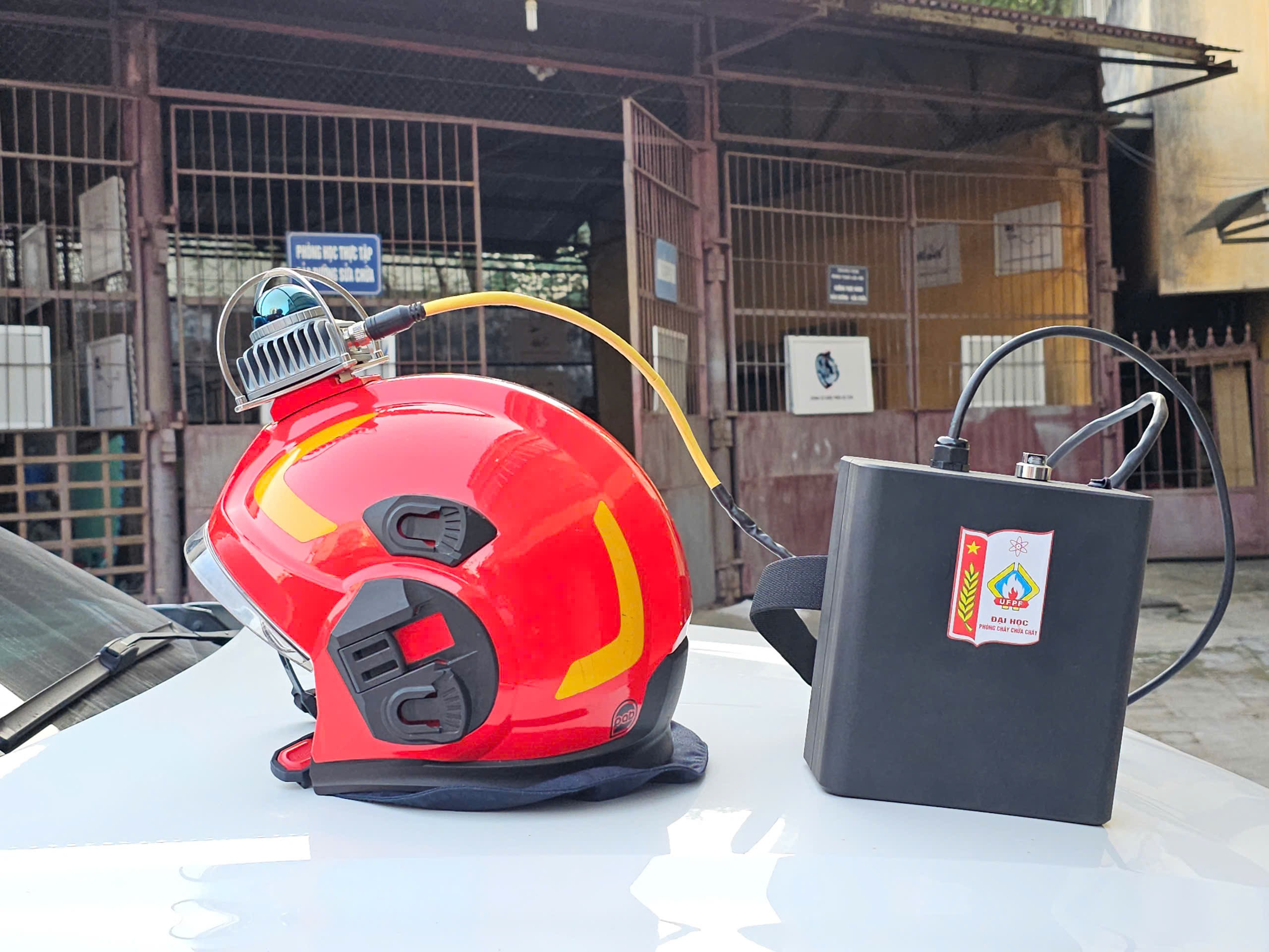
TACTICAL FIELD KIT FOR FIREFIGHTERS ACCEPTANCE PASSED
Includes Helmet-mounted 3D LiDAR unit, Smart computational backpack, and Wall-penetrating tactical wireless repeaters.
WHY FIRES ARE "DEATH TRAPS" & HOW THIS SYSTEM SAVES LIVES
When high-rise buildings, warehouses, or basements ignite, thick black smoke and toxic gases surge violently. Firefighters entering the interior face total blindness, unable to discern corridors, trapped victim locations, or structural collapse hazards.
MINISTRY OF PUBLIC SECURITY S&T COUNCIL REVIEW: ACCEPTED WITH EXCELLENT GRADE
The Ministerial Acceptance Council concluded: The project completed 100% of research goals and contents with outstanding excellence. The 3D LiDAR fireground observation system demonstrates high stability, mission reliability, and critical technical parameters that far exceed target requirements (3D mapping volume up to 30m x 100m x 10m). The breakthrough system opens a new era for firefighting reconnaissance, ready for nationwide tactical deployment.
Naked Eyes & Flashlights: Completely Blinded
Black smoke is laden with millions of microscopic soot particles. High-intensity flashlights reflect off the particulate cloud into a blinding white glare. Rescuers cannot see stair treads 0.5 meters away, forcing them to crawl blindly along walls.
- Cannot see victims even within arm's reach
- High risk of falling into pits or tripping over debris
- Rescuers easily become disoriented in dense smoke
Thermal Cameras: Blinding Glare Near Large Fires
Thermal imagers detect heat signatures, but near raging fires their screens whitewash completely. Crucially, thermal imagers produce only flat 2D pictures, incapable of calculating structural distances to doorways or walls.
- Whitewashes when facing large open flames
- Cannot measure room dimensions or escape route widths
- External commanders remain blind to building floor plans
"Fire-Eye" 3D LiDAR: Penetrating Smoke & Fire
Emitting 200,000 invisible laser pulses per second. Laser pulses slip through microscopic voids between smoke particles, reflecting off walls and furniture. Onboard AI instantly reconstructs the entire structure into a daylight-bright 3D model!
- Penetrates regardless of smoke density
- Reconstructs doors, furniture, stairs, and structural hazards
- External commanders see full layouts to guide firefighters
| Tactical Capability | Naked Eyes & Flashlights | Handheld Thermal Camera | "Fire-Eye" 3D LiDAR (UFPF Project) |
|---|---|---|---|
| Vision in Dense Black Smoke | Total loss (under 0.3m) | Blurred thermal contours (1 - 3m) | Clear sight from 10m to 40m through smoke |
| 3D Architectural Reconstruction | Not possible | No (Flat 2D images only) | Generates 3D model instantly in real time |
| Door & Hallway Width Measurement | Visual guesswork only | Cannot measure | Centimeter-accurate measurement with two clicks |
| Firefighter Telemetry & Localization | Voice audio only | Cannot determine position | Real-time firefighter footsteps on 3D map |
| Water Spray & High-Heat Resistance | Prone to short-circuiting when wet | Standard thermal tolerance only | IP66 waterproof, casing resists up to 250°C |
WHAT DOES THE COMPLETE TACTICAL KIT INCLUDE?
The complete hardware suite is engineered to be ultra-lightweight and compact, allowing first responders to sprint, crawl, climb, and operate fire hose nozzles unhindered.
1. Tactical Helmet with 3D LiDAR Unit
The Livox Mid-360 LiDAR scanner is mounted atop the firefighting helmet within a rugged protective metal cage, spinning 360° omnidirectionally to emit hundreds of thousands of laser pulses per second.
- Ultra-lightweight: Only 265 grams
- Impact-resistant against falling construction debris
- Quick-release locking latch for rapid mounting
2. Smart AI Computational Backpack
Firefighters carry an ergonomic backpack housing an NVIDIA Jetson AI supercomputer equivalent to 10 standard desktop PCs, processing raw point clouds into coherent 3D architectural maps in real time.
- Auto-boots within 10 seconds of power switch
- Thermally insulated aluminum casing prevents back heat transfer
- Long-life battery runs 90 minutes to 2 hours continuously
3. Wall-Penetrating Tactical Wireless Repeaters
A compact unit carried by Firefighter #2 or placed at building entrances. Powered by high-power tactical Wi-Fi 7, it penetrates thick reinforced concrete walls to stream real-time telemetry to the outside command post.
- Ultra-high data throughput up to 5.8 Gbps
- Smooth, zero-latency 3D telemetry streaming
- Maintains unbroken wireless link in deep structures
Complete Tactical Hardware System
Unified, ruggedized enclosure with waterproof rubber gaskets on all connector interfaces.
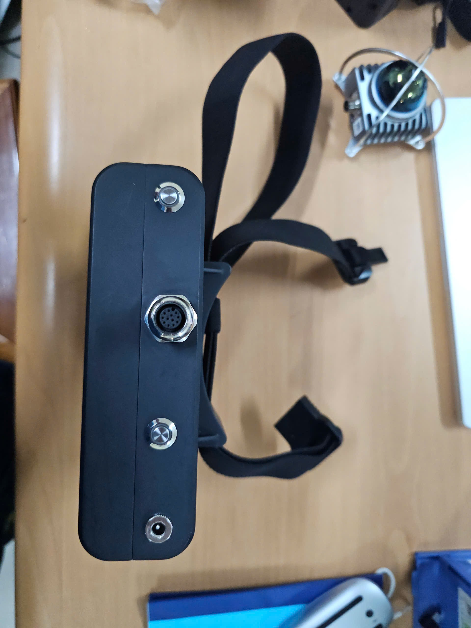
AI Computational Backpack System Active
Green status LED confirms operational readiness; ultra-quiet cooling fan maintains thermal safety.
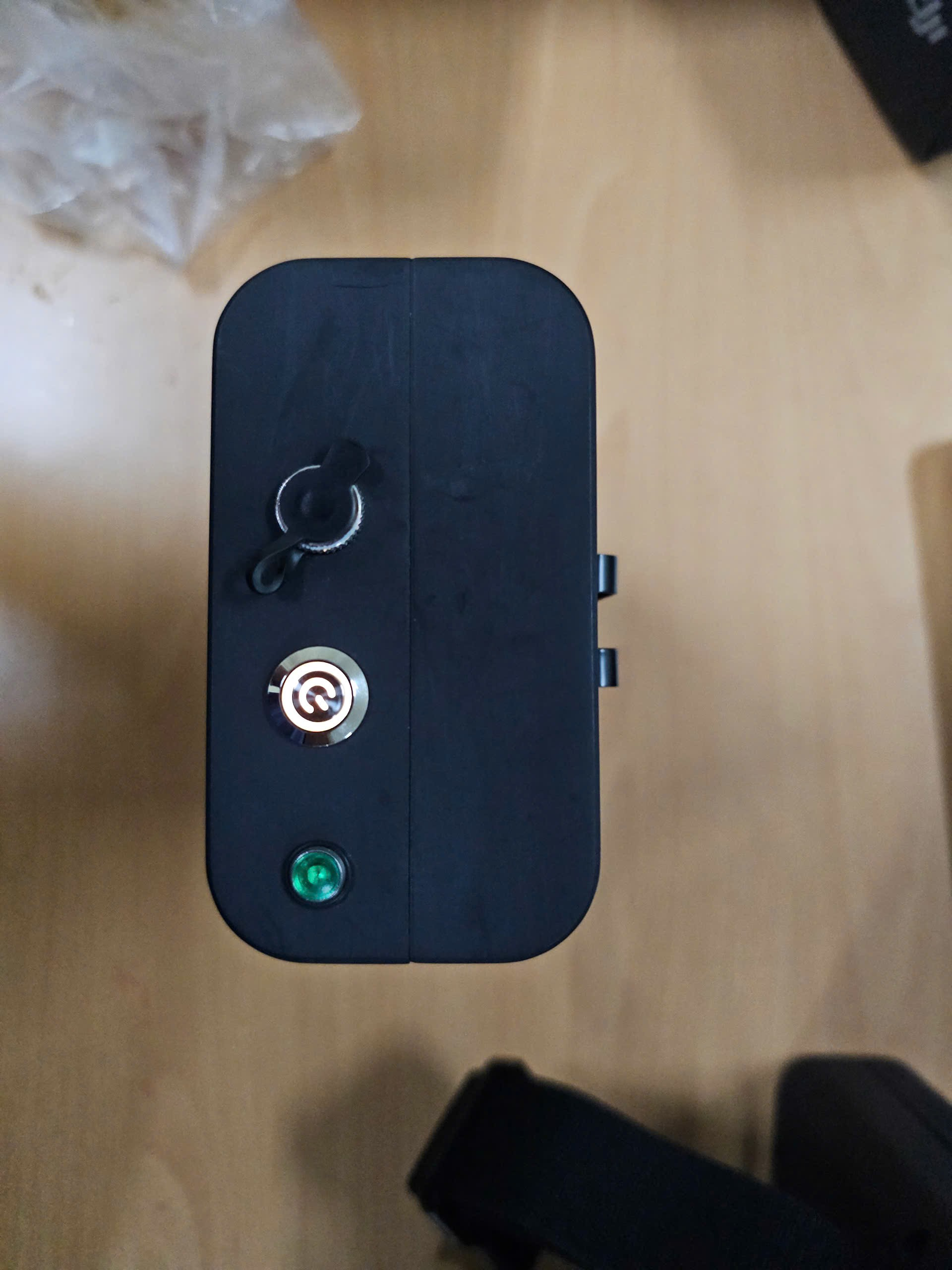
Field Tactical Wi-Fi 7 Repeater
Equipped with high-gain external antennas, relaying long-range wireless links in complex industrial plants.
HOW DOES THE SYSTEM "SEE THROUGH DENSE SMOKE"?
The breakthrough lies in the synergy between 3D laser sensing and artificial intelligence: Lasers penetrate smoke voids to hit solid surfaces, while AI filters away airborne soot noise to reveal crisp architectural walls!
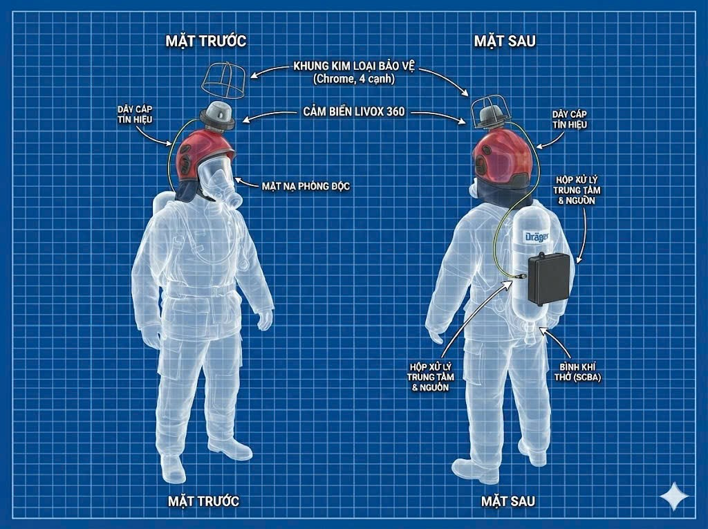
Data Flow from the Fireground to the Command Post
Operating 100% autonomously without requiring complex firefighter interaction:
- Step 1 (Cold Boot): Flip the master switch; all devices discover and mesh with each other in under 10 seconds.
- Step 2 (Laser Scan): As rescuers advance, the LiDAR sensor captures millions of spatial coordinates in real time.
- Step 3 (Smoke Elimination): Edge AI identifies and eliminates soot echoes, preserving only solid structural boundaries.
- Step 4 (3D Visualization): External command posts instantly view the transparent 3D structure and firefighter telemetry.
How Does It Filter Out Smoke, Soot & Water Spray?
A frequent technical question: In dense smoke, why doesn't the system mistake smoke particles for solid walls?
- Weak Smoke vs Strong Walls: Laser pulses bouncing off airborne soot produce faint return echoes, whereas solid walls return strong reflections. AI classifies and filters them effortlessly!
- Chaotic Drift vs Continuous Geometry: Smoke particles drift erratically, while architectural structures form continuous geometric planes. Spatial clustering algorithms eliminate scattered noise and preserve true walls.
- The Result: Outside commanders observe a transparent, crystal-clear 3D model showing every corner with zero smoke obstruction!
WHAT DOES THE EXTERNAL COMMANDER SEE ON SCREEN?
Using the PCCC 3D VIEWER 3.0 software on tablets or laptops, commanders can virtually navigate inside the building, instantly locating fire seeds and trapped victims to coordinate tactical operations.
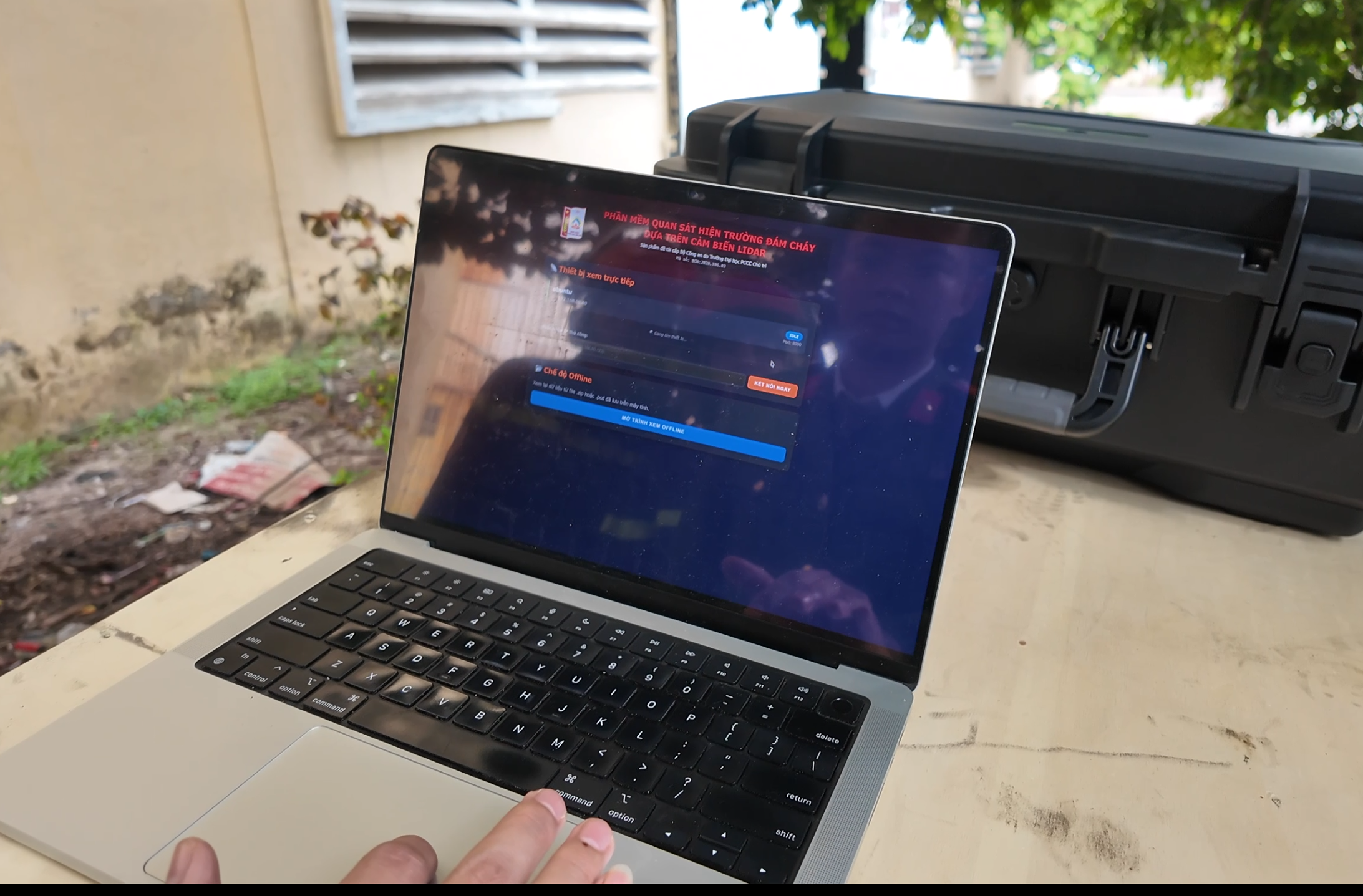
1. Omnidirectional 360° Perspective & Structural Slicing
Commanders can orbit top-down through roofs or slice through exterior masonry, clearly tracking squad locations to warn them immediately if forward structures risk collapse.

2. Real-Time Telemetry: Battery Reserve & Signal Health
The telemetry panel displays battery levels, internal hardware temperature, and wireless RSSI signal quality. In case of anomalies, commanders order immediate evacuation to ensure firefighter safety.
Instant Two-Click Dimension Measurement
Without physical tape measures, clicking two points reveals exact corridor widths and verifies whether emergency escape exits are blocked by debris.
Pin Survival Markers for Victims & Fire Origins
When rescuers spot unconscious victims or explosive gas cylinders, commanders pin red or orange flags onto the 3D map to direct backup squads with pinpoint precision.
Post-Mission Tactical Replay & Investigation
The full mission timeline is permanently archived. Post-fire, investigators and commanding officers can replay the entire operation to reconstruct fire origin and conduct tactical training debriefs.
OFFICIAL DURABILITY TESTING & TECHNICAL SPECIFICATION RESULTS
The system underwent rigorous independent testing and formal certification by the Institute of Special Electronic Technology (P2 - Dept H08) and the Vietnam-Russia Tropical Center (Ministry of National Defense), achieving outstanding quality ratings!
VIETNAM - RUSSIA TROPICAL CENTER (MINISTRY OF DEFENSE)
ENVIRONMENTAL, WATERPROOF, DUST & THERMAL TESTING BODYSubjected equipment to military-grade environmental test chambers with certified conclusions:
- ✔ Absolute water and dust ingress protection certified to IP66 (TCVN 4255:2008 / IEC 60529:2001). Dense soot cannot penetrate, and direct high-pressure fire hose sprays leave the interior completely dry.
- ✔ High-temperature thermal endurance up to 250°C (TCVN 7699-2-2:2011 / IEC 60068-2-2:2007). Specialized Teflon shell and Fluororubber insulation endure 260°C, maintaining internal electronics at a cool 30°C!
INSTITUTE OF SPECIAL ELECTRONIC TECHNOLOGY (P2) - DEPT H08
DEPARTMENT OF SECURITY INDUSTRY • MINISTRY OF PUBLIC SECURITYConducted comprehensive laboratory calibration and verification of all core system parameters:
- ✔ Ultra-Fast Cold Boot: Under 10 seconds from master power switch activation before the system starts receiving spatial data.
- ✔ Continuous Battery Endurance: Operates 90 to 120 minutes continuously; total wearable weight under 1.5kg for maximum mobility.
- ✔ 3D Mapping Volume EXCEEDED TARGET: Target specification was 20m x 20m x 6m; in practice, the system successfully mapped a massive 30m x 100m x 10m industrial plant!
| Specification Item | Ministerial Research Target | Actual Certified Measurement | Accredited Testing Authority |
|---|---|---|---|
| Dust & Water Protection | Target IP66 level | Achieved IP66 (TCVN 4255:2008) | Vietnam - Russia Tropical Center |
| Enclosure Heat Resistance | Withstand 250°C | Achieved 250°C (TCVN 7699-2-2:2011) | Vietnam - Russia Tropical Center |
| Cold Boot Duration | Maximum 10 seconds | 7 - 9 seconds | Institute of Special Technology (P2/H08) |
| Continuous Battery Endurance | Minimum 90 minutes | 105 - 120 minutes | Institute of Special Technology (P2/H08) |
| 3D Mapped Spatial Volume | 20m x 20m x 6m room | Exceptional: 30m x 100m x 10m | Institute of Special Technology (P2/H08) |
| Dimensional Error Tolerance | Deviation under 15 cm | Precision: Under 3 cm | Institute of Special Technology (P2/H08) |
DIRECT TESTING IN RAGING GASOLINE FIRES & DENSE SMOKE
To validate operational readiness, the system underwent trial-by-fire tests inside concentrated smoke chambers at the University of Fire Prevention and Fighting, and live gasoline firegrounds exceeding 500°C at Wanma Cable Factory (Bac Ninh).
TRIAL 1: CONCENTRATED SMOKE CHAMBER AT UFPF MARTIAL ARTS HALL (12 SCENARIOS) XUẤT SẮC 100%
Progressing from 1 to 6 heavy smoke canisters combined with torrential water sprays. While human eyes could not see fingers at arm's length, the system mapped the entire room with under 2.5 cm deviation!
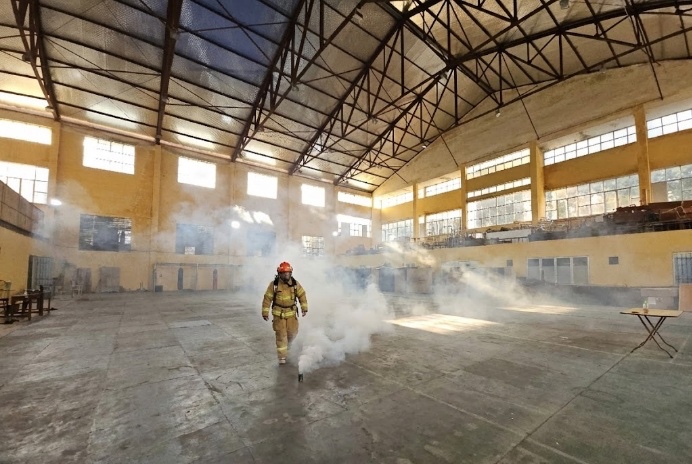
Light Smoke: Eyes sting with degrading sight; sensor maps all room corners.
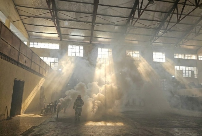
Moderate Smoke: Sight under 1.5m; flashlights scatter into white glare.
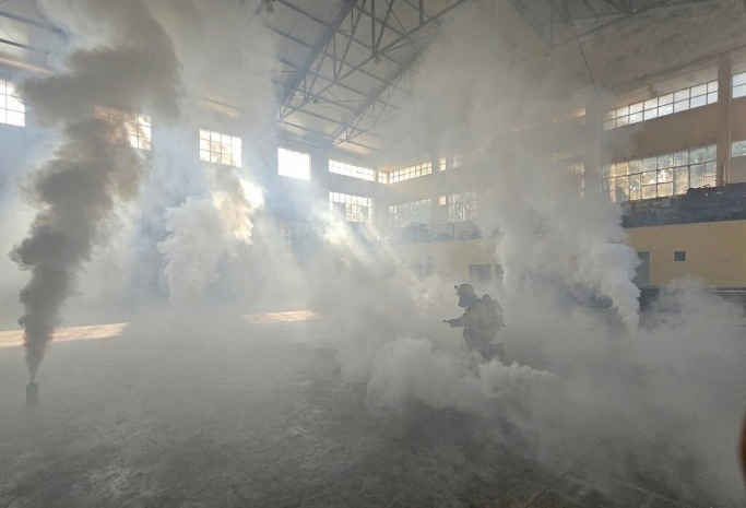
6 Dense Canisters: Sight = 0m; 3D LiDAR sees structural geometry clearly!
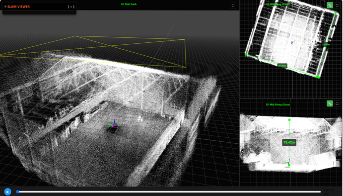
3D Point Cloud: Reconstructs all walls and doors with sub-2.5cm accuracy.
THỬ NGHIỆM 2: NHÀ XƯỞNG SỐ 5 - NHÀ MÁY WANMA CABLE (BẮC NINH) ÁP SÁT LỬA XĂNG >500°C
Conducted in partnership with Tien Son Regional Fire & Rescue Unit (PC07 Bac Ninh): Ignited 3 large fuel trays, thermal cameras recorded temperatures over 500°C, and 4 high-pressure nozzles sprayed water continuously. Firefighters approached the flame edge; electronics stayed cool at 30°C and fully mapped the 100m warehouse!
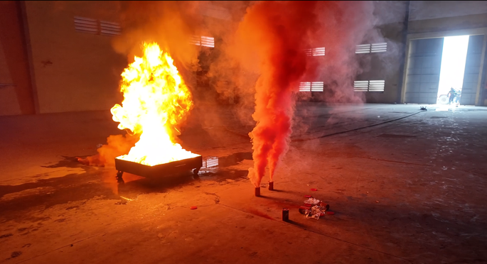
Raging gasoline flames ignite; dense black smoke blankets the ceiling.
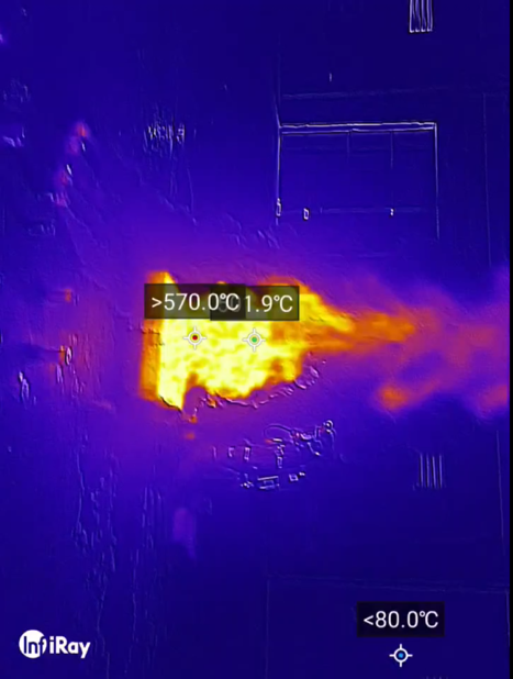
Thermal proof: Flames exceed 500°C directly beside firefighters.
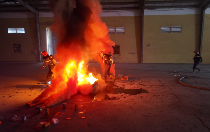
Firefighter approaches flame boundary; internal electronics stay cool at 30°C.
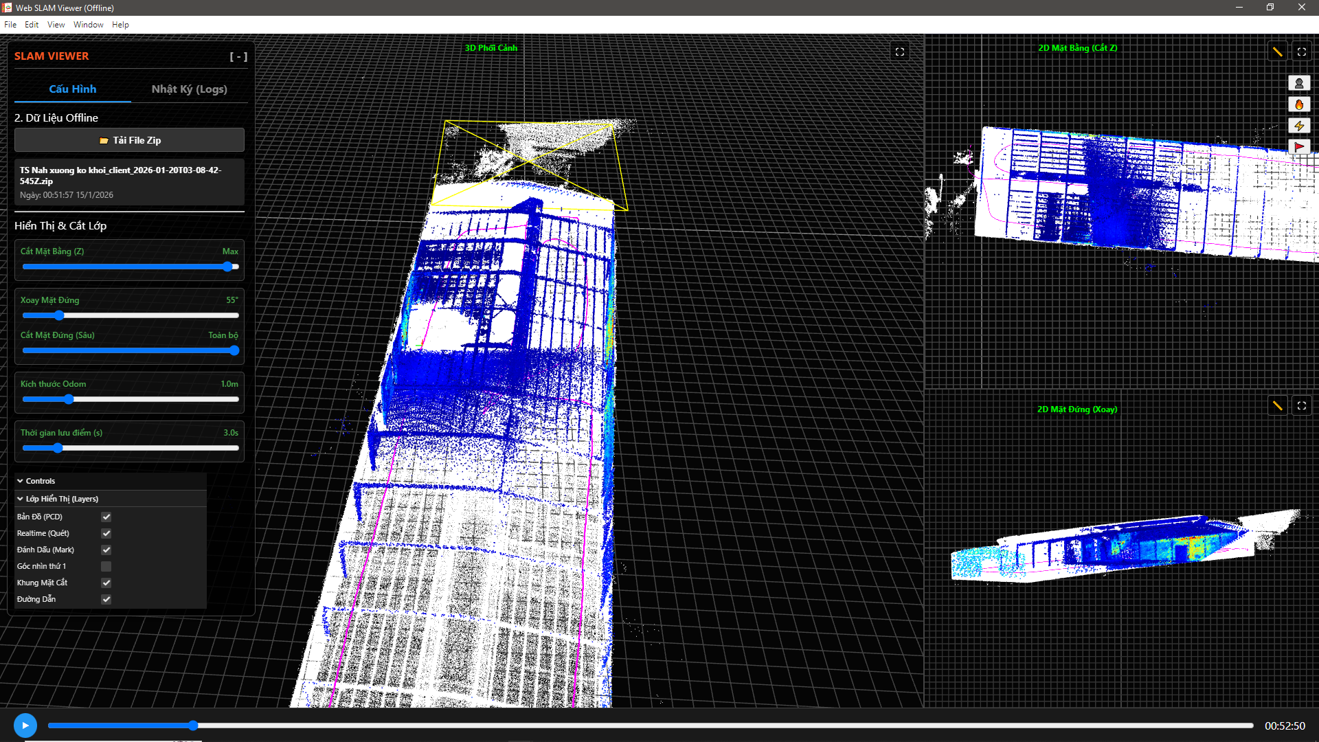
All machinery rows and structural columns appear on the commander screen.
4 RAPID DEPLOYMENT STEPS ON ARRIVING AT A FIRE SCENE
Every procedure is maximally streamlined so firefighters require less than 1 minute to deploy and advance into burning structures to save lives.
Step 1: Daily Pre-Deployment Vehicle Inspection
Inspect helmet LiDAR mounting latch, verify battery voltage indicator (>12V), clean optical laser window, and check waterproof rubber sealing caps.
Step 2: Initialize Command Post & Boot Wireless Repeaters
Upon arriving on scene, the commander sets up the rugged field laptop in the safe zone; powers on industrial repeaters to establish deep wireless mesh coverage.
Step 3: Power On System & Advance Into Structure
Firefighter #1 (helmet sensor) and #2 (mobile repeaters) flip master power; green LED lights up in 10s; the pair advances in coordination to search for victims.
Step 4: Commander Navigation & Safe Victim Evacuation
Commander monitors 3D map to navigate squad via radio: "Turn left for window, room ahead is clear!". Post-mission, wipe soot and dock units onto charging stations.
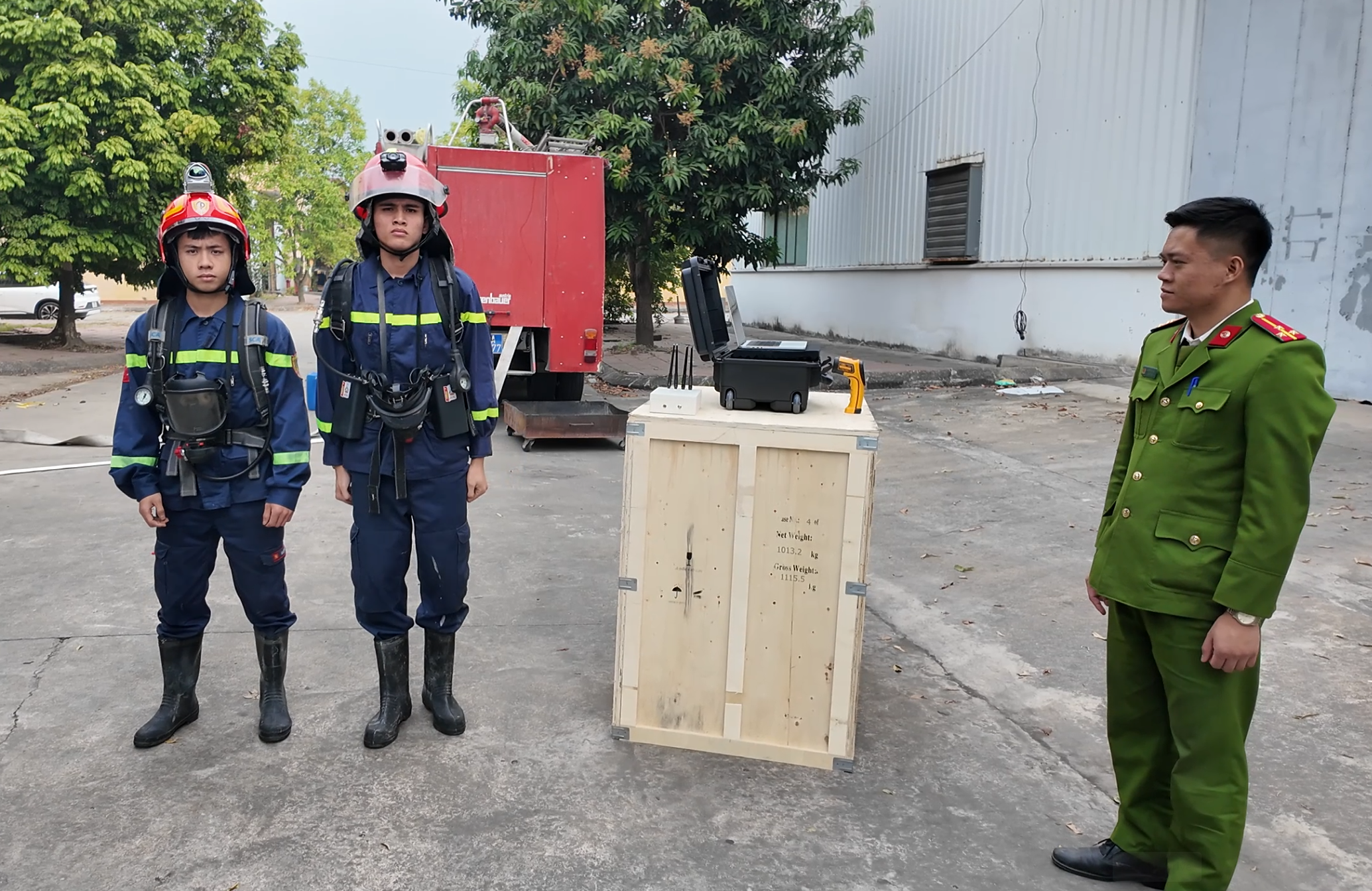
2-Firefighter Coordinated Tactical Squad
Firefighter #1 leads the reconnaissance to map terrain, while Firefighter #2 provides rear cover and drops wireless relays, establishing an unbroken telemetry bridge from inside the inferno.
THƯ VIỆN ẢNH THỰC TẾ HỆ THỐNG & NHỮNG CHUYẾN THỬ LỬA
A curated archive of 22 high-resolution field photographs documenting hardware kits, dense smoke tests, and 500°C gasoline fire trials. Click any image to open full-screen lightbox.
Complete tactical equipment kit for firefighters
Includes helmet-mounted 3D LiDAR unit, computational backpack, and field-deployable wireless repeaters.
How the system operates on the fireground
Firefighters enter intense smoke to scan spaces while wireless telemetry streams real-time 3D data to commanders outside.
Smart AI computational backpack on firefighter's back
Houses a high-performance compact AI computer, waterproof and thermally insulated casing, with green status LED.
Wall-penetrating field tactical wireless repeater
Relays data through multiple thick reinforced concrete walls and steel structures, ensuring zero lag or signal drop.
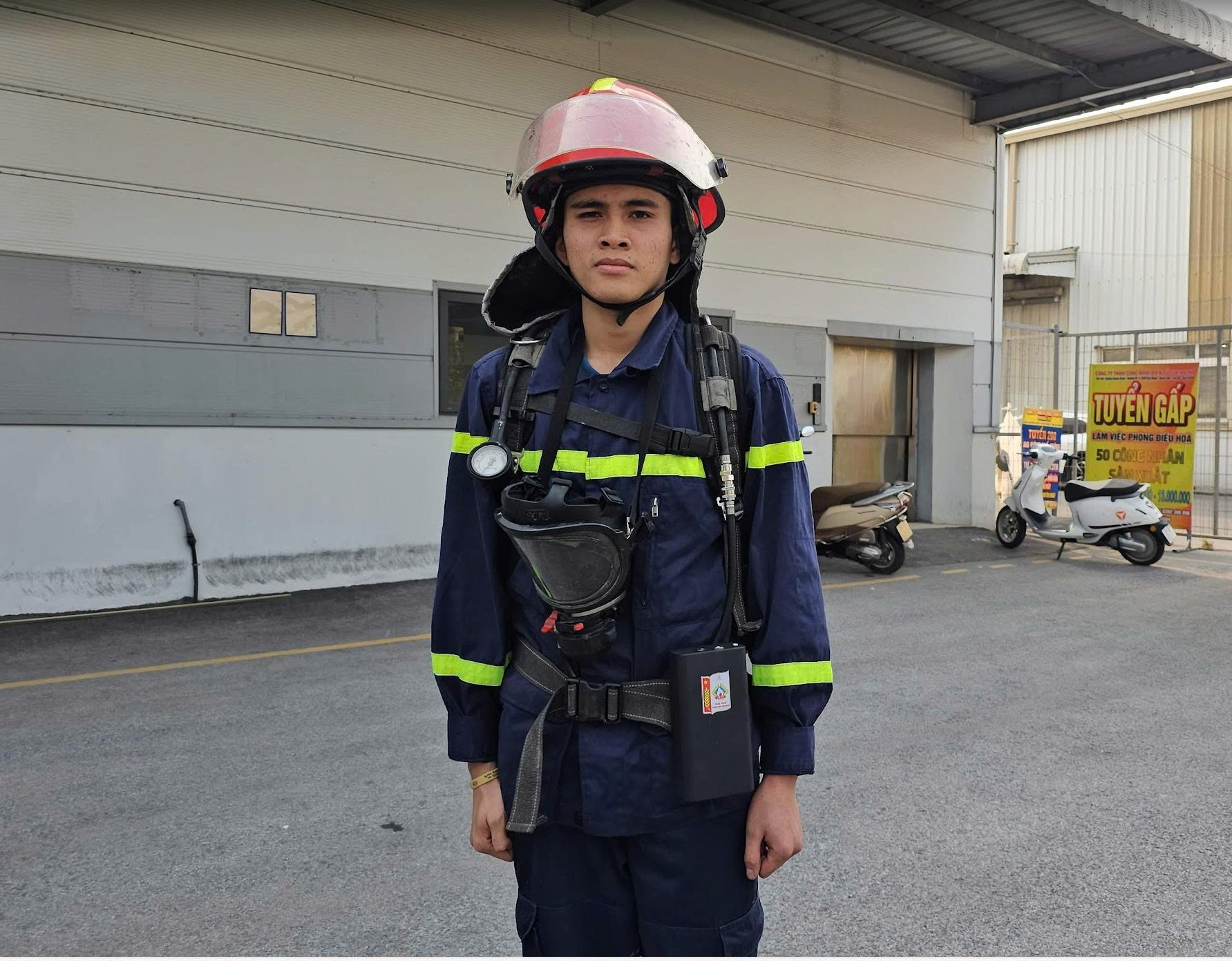
Firefighter #2 carrying mobile relay module
Provides rear cover and mobile communication bridging, extending signal paths from deep basements to the command vehicle.
Reconnaissance squad advancing into burning structure
Two firefighters advance in sync; helmet sensor scans every square meter while commanders navigate them from outside.
Commander Display: Seeing through walls and dense smoke
Commanders inspect the building layout as a transparent 3D model, clearly identifying every door, stair step, and emergency exit.
Firefighter real-time safety telemetry dashboard
Monitors battery reserve, wireless RSSI signal strength, and hardware core temperature for timely evacuation alerts.
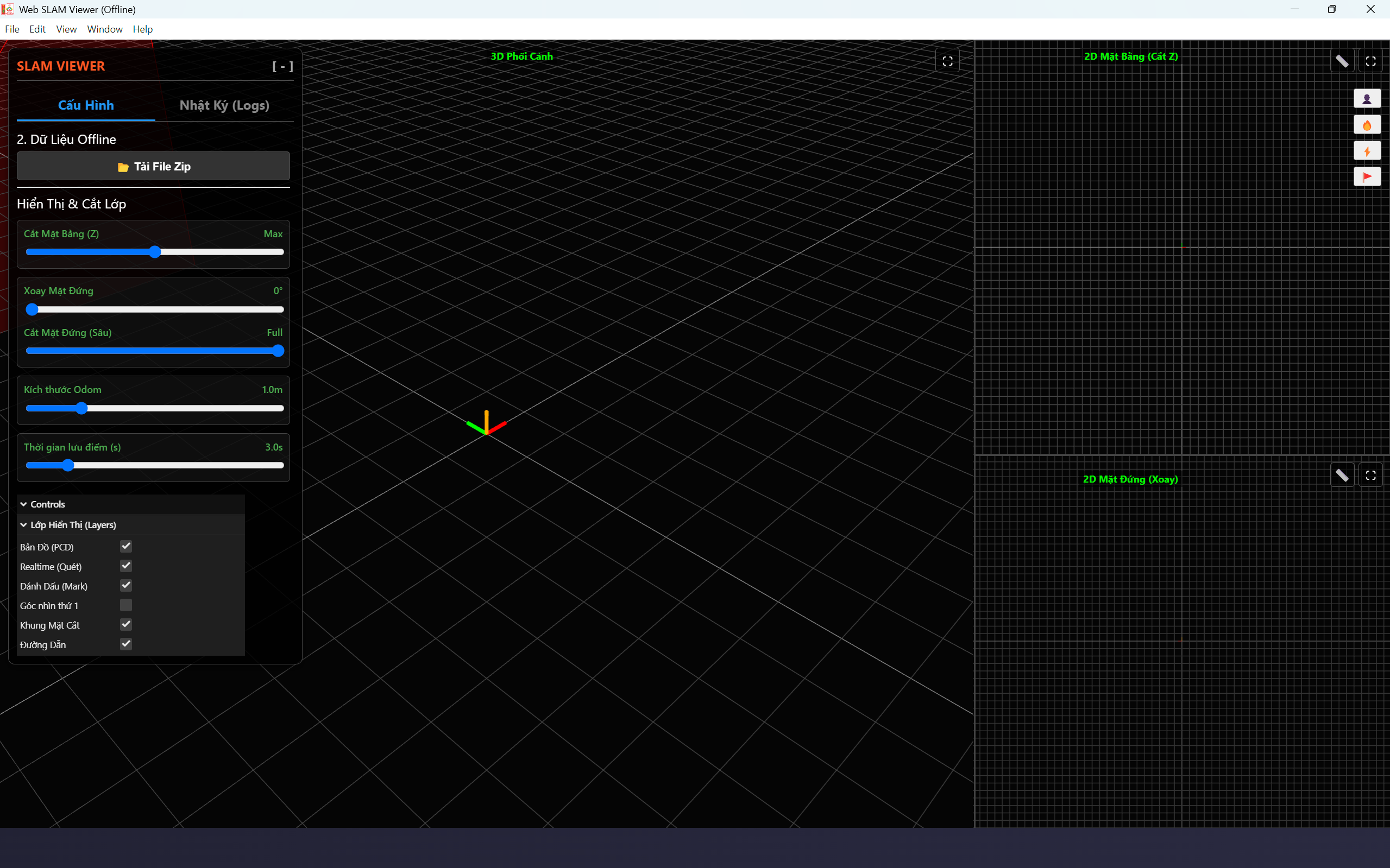
Direct mouse-click measurement of doorways and rooms
Commanders measure corridor clearances and window dimensions with two clicks to verify stretcher passage.
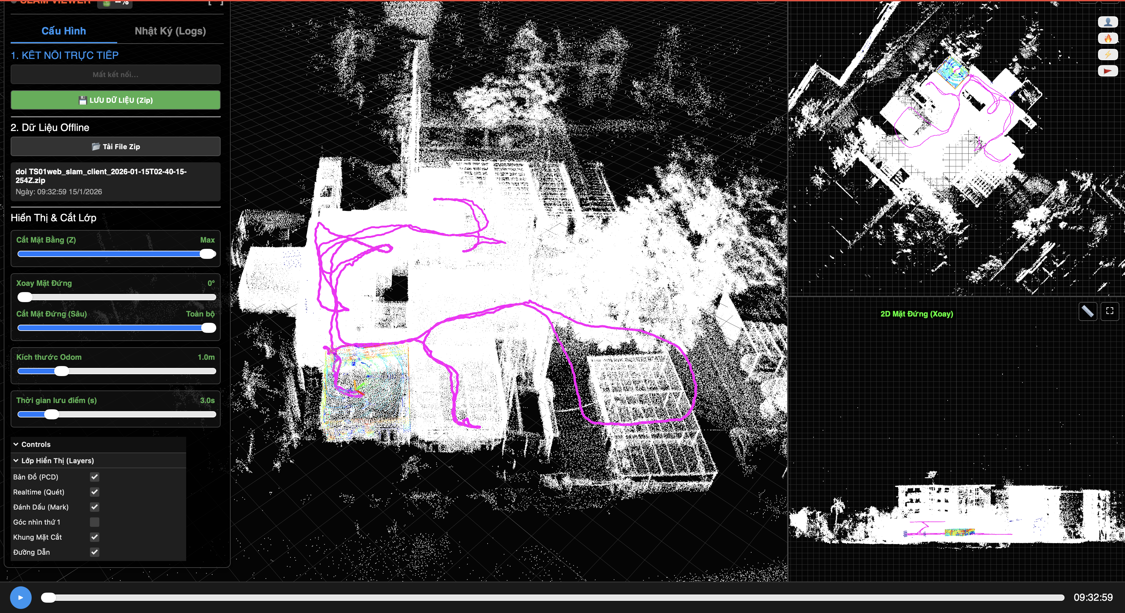
Complete building reconstructed into high-definition 3D
Despite pitch-black smoke inside, the structure appears centimeter-accurate and crystal-clear on the command screen.
Light smoke test: Human vision starts degrading
Artificial smoke rises; naked eyes blur, but the helmet laser scanner has mapped every corner of the room.
Moderate smoke test: Visibility drops below 1.5 meters
Dense smoke engulfs room; flashlight beams scatter into white mist, yet the system accurately identifies every obstacle.
Pitch-black dense smoke: Zero human visibility
Ignited 6 heavy smoke canisters; firefighters cannot see their hands, yet the commander screen outside displays crisp geometry!
Room 3D point cloud mapped with centimeter accuracy
All four walls, ceiling, and floor appear intact, showing less than 2.5 cm deviation from mechanical laser tape measures.
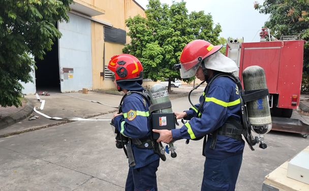
Preparing for live industrial fire trial at factory
Firefighters conduct final pre-entry equipment checks before tackling a multi-thousand square meter industrial warehouse.
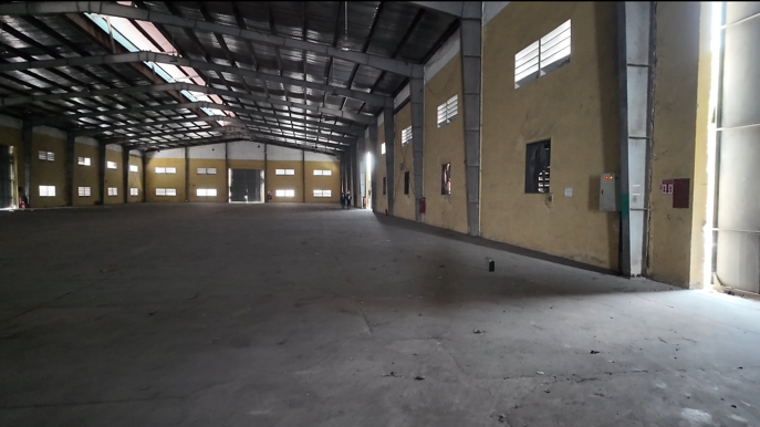
Factory Hall #5 prepared for live fire drill
Large industrial workshop with intricate machinery, steel columns, and overhead cable manufacturing lines.
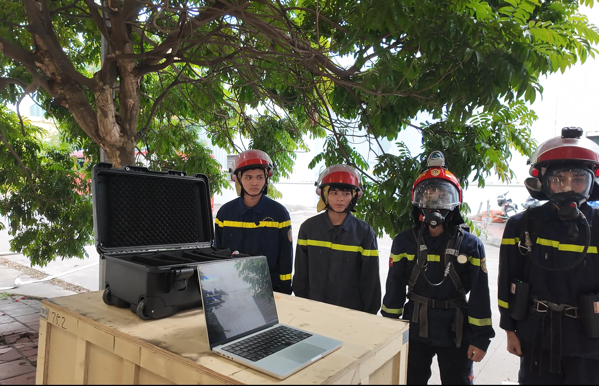
Tactical command desk safely stationed outside factory
Commander stationed outside monitors real-time 3D spatial telemetry streamed wirelessly from helmet sensors.
Raging gasoline fire and dense soot blanket factory
Ignited 3 large fuel trays producing blazing fire columns and thick black smoke; internal temperatures escalated violently.
Thermal camera confirms flame temperature >500°C
Thermal infrared imaging measured fire temperatures exceeding 500°C directly adjacent to operating firefighters.
Firefighters wearing kit approach 500°C inferno
Thermal insulation kept internal electronics cool at 30°C; system maintained continuous mapping with zero interruption.
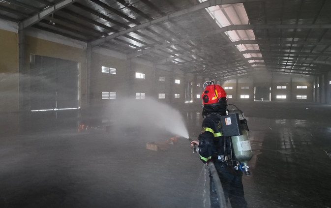
Operating equipment while suppressing fire with high-pressure hose
Four fire nozzles sprayed torrential water; IP66 casing remained bone-dry with zero moisture ingress.
3D point cloud of entire 100m factory completed in minutes
Despite dense smoke and flames, the system digitized the entire 100m industrial facility, granting commanders total visibility.
3D VIEWER COMMAND POST SOFTWARE SIMULATION
Experience the live tactical command post software running 100% offline without Internet dependency. Experimental dataset recorded during actual fire trials on March 24, 2026 at Wanma Cable Factory. Features 3 synchronized viewports: 3D Perspective, 2D Floor Plan (Z-Cut), and 2D Elevation (Rotate).
Fire Command Post 3D Viewer
To achieve smooth 60 FPS performance and prevent high memory usage on mobile devices, the 3D Point Cloud system is optimized to launch in a standalone full-screen window.
🚀 LAUNCH 3D VIEWER (NEW WINDOW)3D Orbit & Zoom
Left-click & drag to orbit 360°, right-click to pan, scroll wheel to zoom into room details and structural obstacles.
Floor Plan Z-Slicing
Drag the Z-elevation slider to slice through building heights, revealing corridors, escape routes, and trapped victim locations.
Tactical Path Replay
Click Play or drag timeline to replay the exact path taken by reconnaissance firefighters as they navigated deep into the scene.
Measurement & Waypoints
Click to measure hallway/door widths and drop tactical waypoint pins for Victims (👤), Fire Seeds (🔥), and Hazards (⚡).
PRODUCT FEEDBACK & EXPERT REVIEWS
All evaluations, professional feedback, and technical suggestions from partner agencies, institutions, and firefighting experts provide invaluable guidance for our research team to continuously refine and elevate our 3D LiDAR system for real-world missions.